
🥾 GREAT WHERNSIDE WALK: KETTLEWELL TO PROVIDENCE POT CIRCULAR ROUTE
🏞️ This circular Great Whernside walk starts and finishes in the picturesque village of Kettlewell, climbing through the Dowber Gill Beck valley to Providence Pot before passing Hag Dyke and continuing to the summit of Great Whernside. From the high ridge, the route heads north across open moorland before sweeping around the head of the valley and returning to Kettlewell by way of Starbotton Road and Top Mere Road.
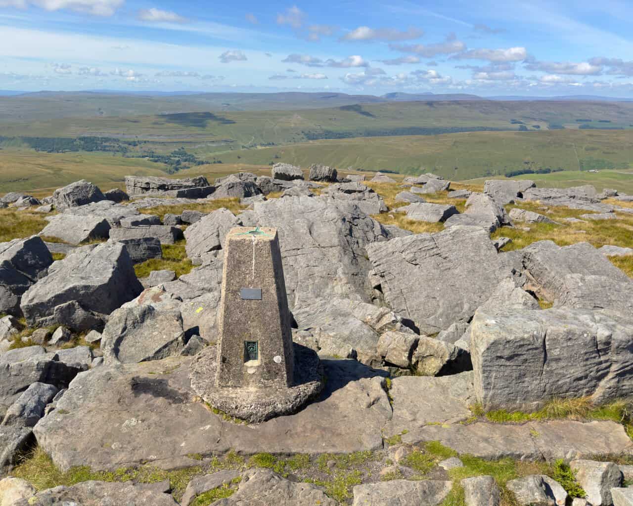
🧭 Leaving Kettlewell, the route follows Dowber Gill Beck for about a mile to Providence Pot, the capped entrance to an extensive cave system beneath the valley. A steep path then climbs to Hag Dyke before the ascent continues across rough, sometimes boggy moorland to the 704-metre summit of Great Whernside. From the triangulation pillar, the walk follows the ridge north towards Black Dike Hole, descends to a minor road and then joins old bridleways for the long return towards Kettlewell.
📏 The walk covers 8 miles, or 12¾ kilometres, and takes around 4¼ hours, with a total ascent of 1,929 feet, or 588 metres. It is a circular route in the Yorkshire Dales, with parking available in the Yorkshire Dales National Park pay and display car park in Kettlewell. The recommended map is OS Explorer OL30, and detailed versions of the route are also available through OS Maps and Outdooractive.
⛰️ Great Whernside rises to 704 metres, or 2,310 feet, on the eastern side of Wharfedale and forms part of the watershed between Wharfedale and Nidderdale. Its name can be traced back to 1214 and refers to a hillside associated with querns or millstones, an appropriate description given the great slabs of millstone grit scattered across the summit. The mountain also has a long human history, with Tor Dike on its north-western flank, the former farmhouse and present-day hostel at Hag Dyke, and the Providence Pot and Dow Cave system hidden beneath the surrounding limestone.
📷 One of the pleasures of this walk is how often the landscape changes. The sheltered Dowber Gill Beck valley gives way to steep hillside paths, open peat and a boulder-covered summit where the views can stretch west towards Pen-y-ghent, Ingleborough and Whernside. The descent brings a different character again, with afternoon light across the moors, quiet stretches beside dry stone walls and increasingly wide views down Wharfedale towards Kettlewell. On my visit, unusually dry conditions exposed much of the rocky bed of the beck and made the normally boggy higher ground easier to cross.
🌄 This is a varied day on the fells, combining limestone valleys, cave-country history, a substantial summit, wide-ranging views and a long, peaceful descent back into Wharfedale. If you would like to see the complete route directions, photographs, statistics and mapping information, you can explore the Great Whernside walk in full on my website.
https://www.paulbeal.com/great-whernside-walk