

The last few weeks have mostly been spent on war diaries and maps again, and two of the diaries are now complete on the site: the 8th Infantry Brigade HQ diary (WO 171/611) and the 4th County of London Yeomanry's 1944 diary (WO 171/856).
The image below shows the current progress of georeferencing process.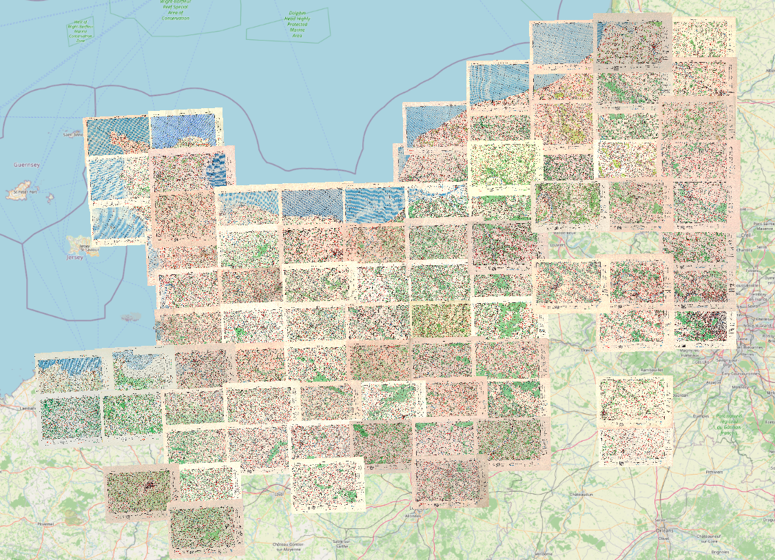
8th Infantry Brigade HQ, 1944
The final seven months of the 8th Infantry Brigade HQ's 1944 diary are now up. July to September are missing from the original document, so unfortunately I've not been able to add these.
The first four months follow the brigade's long build-up to D-Day. January was spent on amphibious assault training and Exercise GRAB, with a move to Dumfries. In February the C-in-C 21 Army Group visited the brigade's units, in between Exercises MORAY, ANCHOR, CACKLE and BARON. March centred on Aberlour and Auldearn for full-scale rehearsals, Exercises BARON and LEAPYEAR among them. In April the brigade moved south from Auldearn to Emsworth, with Exercises AMBLE, HANDSUP, MOCK-UP and FABIUS, an artillery shoot at Larkhill and RAF concentration bombing practice at Studland.
October picks the story up in Holland. Under Operation AINTREE the brigade advanced from the Mook to Heumen line, assaulted Overloon on 18 October, then crossed the Molenbeek to take Venraij. On the 26th Brigadier E.E. Cass was injured by a mine and evacuated, and the next day Brigadier E.H. Goulburn took command. November settled into a static winter role south of Overloon along the River Maas, with constant patrolling towards the river and efforts to reduce a German-held castle at Kasteel. December rotated the brigade through rest areas at Gemert, Boekel and Horst before it returned to the line near Venraij, with a reminder that there was to be no slackening of alertness over Christmas.
4th County of London Yeomanry, January - March 1944
The 4th CLY's diary only runs from January to July 1944, so with January to March now uploaded, it's complete. January opens with the regiment landing at Greenock, disembarking via King George V Dock and moving to its new home at High Ash Camp near Thetford. February brought new Cromwells and Centaurs, a parade at Didlington Hall for the C-in-C, and on the 24th a visit from the King, who inspected the camp and the tanks before all ranks turned out to cheer him on his way. In March firing parties went to Kirkcudbright and AFV range work ran at Titchwell and Boyton, while more Cromwells, Crusader AA tanks and Humber Scout Cars kept arriving.
Two New Maps
Two more GSGS 4250 sheets are in the archive. 8G/4 La Loupe is one of the batch I mentioned back in August as georeferenced and waiting, and 6G/5 Fougères carries the Brittany coverage further south.
8G/4 La Loupe War Office 1943, printed June 1944. Longny, Rémalard and La Loupe
6G/5 Fougères War Office 1943. Fougères, Saint-Aubin-du-Cormier, Liffré, Sens-de-Bretagne and Châtillon-en-Vendelais
More have been georeferenced, pushing further south and filling some gaps to the east. I'm finishing them off now, so they should start appearing over the next few weeks.
Bourne Wood and the Currahee Runs
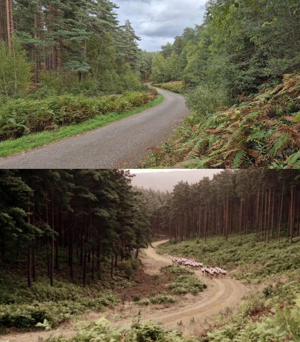 I recently visited Bourne Wood near Farnham in Surrey, where the Currahee training runs in the first episode of Band of Brothers were filmed. In the series the slopes stand in for Currahee Mountain at Camp Toccoa, Georgia, where Easy Company ran "three miles up, three miles down" under Herbert Sobel.
The photo is featured in the new article, Where Was Band of Brothers Filmed?, which goes episode by episode through where the series was filmed, from Bourne Wood and Hambleden to the backlot at Hatfield, and what the real places look like today.
Tanks in Normandy
There's also a new article, Tanks in Normandy, a guide to the wartime tanks you can still see across the region, from the Shermans standing as memorials, such as "Massaoua" at Écouché, to the Sherman DD "Bold" at Courseulles-sur-Mer, which sank off the beach on D-Day.
Behind the Scenes: Map Downloads and a New Drive
I've added a shop for high resolution downloads of the maps. It has some of the more popular sheets to start with, the Caen, St Lô, Isigny and Valognes area maps among them, and I'll be adding more soon.
Part of the reason is the cost of the mapping itself. Digitising and georeferencing these sheets is already consuming hundreds of gigabytes of disk space, and I've been getting by for a while by moving files around and deleting what I can. It has now reached the point where that won't work anymore, so this week I'll be ordering an internal SSD with several terabytes to carry on with the mapping project, and an external drive of a similar size for backups.
The plan for the site has been, and continues to be, to provide free access to these materials, and the maps will stay free to view as they always have been. The downloads are a compromise to help offset some of the costs of creating and sharing these resources. Normandy War Guide is still a passion project, and one I genuinely enjoy doing.
What's Coming
With the 8th Infantry Brigade finished, I'm now working on the No. 8 Beach Group 1944 war diary (WO 171/812), one of the diaries I picked up on the quick stop at the National Archives on the way to Tbilisi.
The map page is also being overhauled, with a better design, easier use and some new features. I hope to have more to show on that in a future update.
Thank you, as always, for supporting the site. It's a big part of why I can keep adding maps and diaries and keep them free for anyone who needs them.
Phil