

A fair bit to share this time. Five pre-D-Day diaries for 241 Provost Company are now published, covering January to May 1944, and the 1st King's Own Scottish Borderers June and July 1944 diaries are both live. A new map has been added to the archive, and there are a few updates to the site itself worth mentioning.
War Diary: 241 Provost Company: January to May 1944
I've just published the five remaining diaries for 241 Provost Company, covering January to May, completing the diaries for 1944. During this period the unit was training and taking part in exercises including Crown, Anchor, Gimlet, and Leapyear. By late May they were marshalled into sealed camps ready for Operation "Overlord".
War Diary: 1st King's Own Scottish Borderers: June and July 1944
In the last update I mentioned starting the transcription of the KOSB diaries. I've now published the diaries for June and July 1944. The June diary covers the battalion coming ashore at Hermanville-sur-Mer on 6 June between 1145 and 1445 hours and pushing inland through Périers-sur-le-Dan toward Caen.
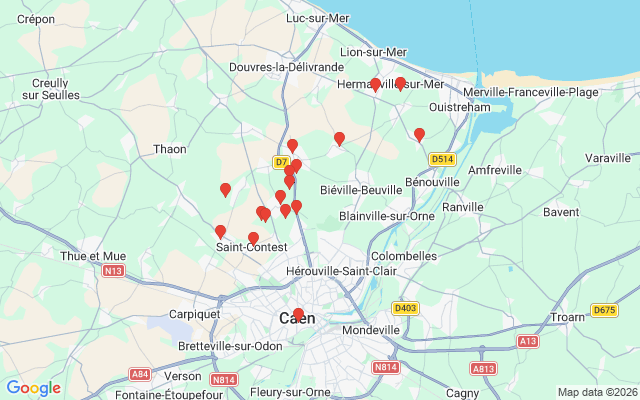 1st King's Own Scottish Borderers June 1944
July brought two major operations. Operation Charnwood on the 9th was the assault on Caen itself. Operation Goodwood followed on the 18th, pushing south-east toward Troarn. The fighting on 18 and 19 July cost the battalion 12 officers and 140 other ranks.
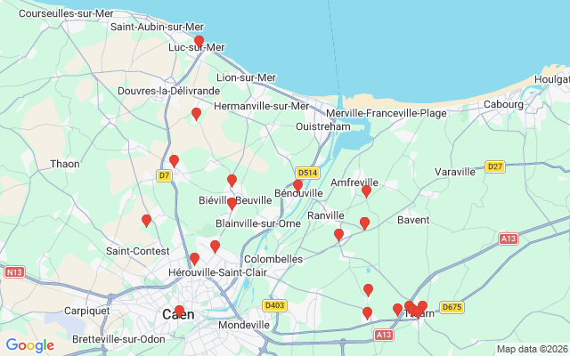 1st King's Own Scottish Borderers July 1944
New Map: 8F/4 - Bernay
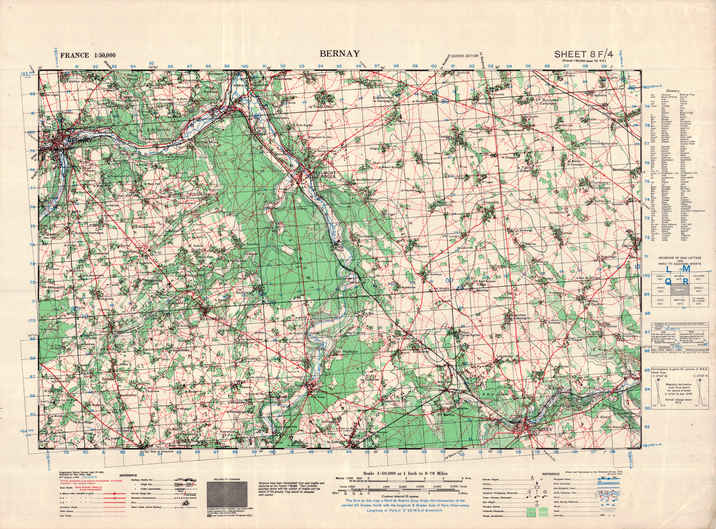 The latest addition to the GSGS 4250 archive is 8F/4, covering Bernay at 1:50,000. It's part of a batch I'm working through east of the current coverage, running from around Dieppe down toward Évreux. More on that below.
Behind the Scenes
I've completed most of the development of the static maps API I mentioned last time. I'm just finishing up the testing and making a few final refinements. It can generate map images from both modern and WW2 base maps, and supports the automatic drawing of single or multiple points.
The Operation Aquatint article has been updated with a photo of the graves at Saint-Laurent-sur-Mer and some additional detail on the September 1942 raid by Major Gus March-Phillipps and the Small Scale Raiding Force. One of those operations that deserves to be better known.
What's Coming
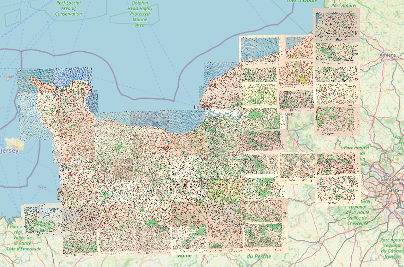 I'm expanding the GSGS 4250 map coverage eastward, working through sheets from Dieppe down to Évreux. The maps are georeferenced in batches because each sheet needs to align cleanly with its neighbours as part of the mosaic. Progress can look slow until a batch is ready to release, but the result is much more accurate joins across the whole area. Once this stretch is done it will open up coverage for a lot of the British and Canadian operations from the later summer of 1944.
As always, thank you for your support. It genuinely helps me keep the servers online and to continue adding new resources.
Phil