

🗓 Date: May 28, 2025
📍Location: Manaus, Brazil
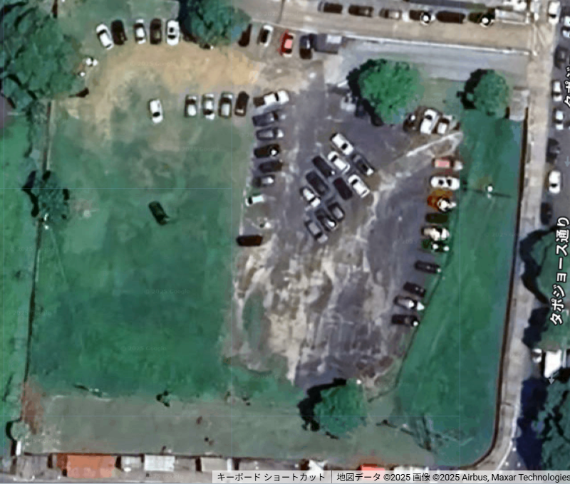
Suspected archaeological site: Open land south of Hospital Rio Negro
Coordinates: -60.023207, -3.124824
✅ Overview
Guided by early 20th-century literature describing red clay urn (Igapaba) burial practices near old fortifications,
I initiated an AI-assisted geospatial analysis using Google Earth Engine to identify signs of unknown ruins beneath modern Manaus.
🔍 Tools Used
Google Earth Engine (GEE)
NDVI (Normalized Difference Vegetation Index)
DEM (Digital Elevation Model)
Satellite imagery + intuitive visual inspection
📊 Today's Discovery Summary
AspectResultNDVIValues ranged from 0.04 to 0.26 — Unusually low, indicating barren or disturbed soil (possibly clay exposure or past excavation)DEMUnavailable at key point — potential data masking or terrain anomalyVisual signsAerial view revealed patchy surface, irregular ground cover, and faint geometric disruptionsHistorical matchStrong alignment with literature describing burial urns found near city ramparts
📍 Next Steps
Re-attempt DEM retrieval and analyze elevation profile along transects
Create a grid-based scoring model combining NDVI/DEM anomalies
Compose a GPT-assisted hypothesis about cultural-layer probability
☕ Support This Exploration
If you believe in AI-assisted archaeology and digital fieldwork revealing forgotten truths,
you can fuel this mission via BuyMeACoffee.