

invest 95L may become TD #6 by Mon
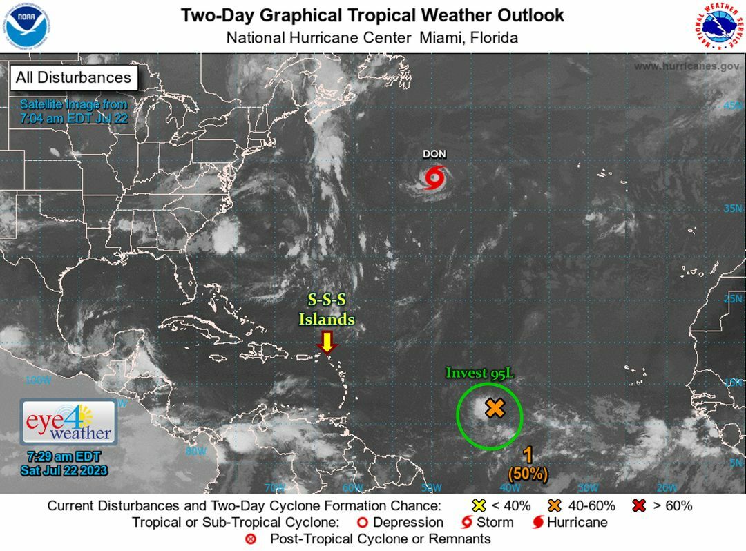
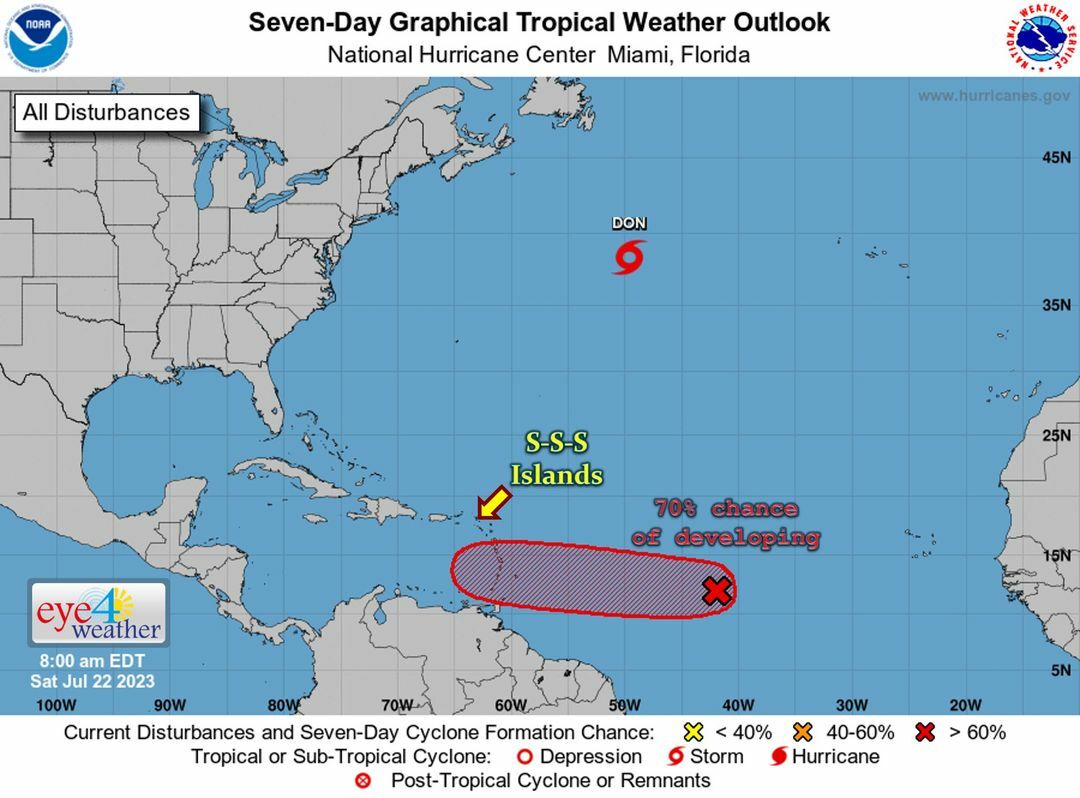
* Green: The developing tropical wave (aka invest 95L) now has a medium (50%) to high (70%) chance of developing within the next 2-7 days .
...it is currently centered +/- 12°N 40°W, moving West (towards the Caribbean) at 10-15 kts.
...this trop. wave is projected to develop slowly and could become a tropical depression by Mon.
...regardless of development, it will likely bring showers to the southern Caribbean on Mon & Tue, and possibly the northern islands (including the SSS Islands) late Tue into Wed.
We will continue to monitor the Atlantic.
#RemainAlert #StayPrepared
Keep checking back for updates
________________
2023 Hurricane Season:
>> So far: 5 trop. storms -- incl. the 1 in Jan'23
>> Expected: 13-18 tropical storms, 6-8 hurricanes (3-4 major)
* Normal Season: 14 TS, 7 H (3 MH) --> 2023 = near-average!
________________
Note: Typical development of a tropical system:
Tropical Disturbance/Tropical Wave --> Tropical Depression --> Tropical Storm --> Hurricane --> Major Hurricane
________________
Courtesy: Eye 4 Weather