

‼ Lee down to Cat-3 ‼
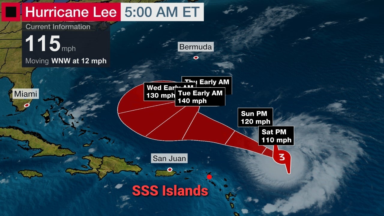
5am stats on the CENTER of Lee:
> Location: 19.7°N 57.4°W
...or +/- 390 mi ENE of St. Maarten
...or +/- 405 mi ENE of Saba
...or +/- 395 mi ENE of St. Eustatius
...or +/- 385 mi ENE of Anguilla
> Winds: decr. to 115 mph (Cat. 3)
…Fluctuations in strength (up & down) expected over the weekend, but Lee is forecast to remain a powerful Hurricane well into next week.
…Regardless, Lee is expected to remain at a “safe” distance from the SSS Islands.
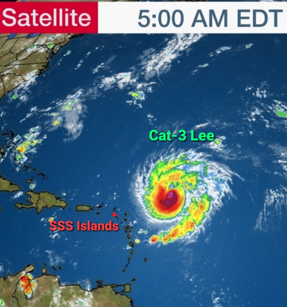
> it's moving: slower WNW @ 12 mph
...Minor effects to the SSS Islands are expected today & Sun (Rough Seas, couple Showers, possible Thunder/Lightning, Light Winds, low chance of flooding); "normal" winds expected from Mon on.
>> The CENTER of Lee is expected at its closest (+/- 280mi) NE of the SSS Islands +/- Sun afternoon -- as a Major Hurricane.
...Effects from its OUTER BANDS will be felt throughout the weekend -- with improvements expected by Mon/Tue.
…Note: Hurricane force winds (75 mph+) extend out 30 miles of the center.
Tropical Storm force winds (40 mph+) extend out 175 miles of the center.
______________
Reminder:
* St. Maarten = 18.0°N, 63.1°W
* Saba = 17.6°N, 63.2°W
* St. Eustatius = 17.5°N, 63.0°W
______________
Next update: +/- 11:30am
#StayCalm #BeAlert #itCouldHaveBeenWorse