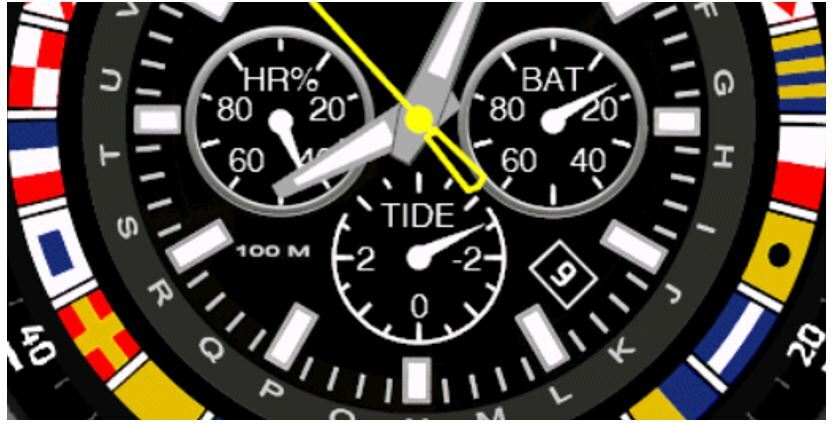
Just for fun and interest, I added a simple tide level display option to the Semaphore watchface. This uses your GPS position to obtain the estimated tide level (relative to mean sea level) from the Stormglass service. A free API key is required from https://stormglass.io/ . The outside arc on the subdial shows the tide level range (in this picture, low tide is -2.8 meters and high tide is +2.7 meters). The units follow your Garmin watch "elevation units" setting (meters or feet).
You need to give the watchface your GPS position the first time you use this feature. Please see the post below for how to do this:
https://www.buymeacoffee.com/trudelta/faq-displayed-parameter-updating
After the watchface has your latitude/longitude position and a Bluetooth communication link is established to your phone, the Garmin Connect app is running on your phone, and your phone can access the internet, it can take up to 5 minutes for the tide level to be indicated.
DISCLAIMER: Actual tide levels depend on many factors including the distance between your location and the tide station used, wind and other local conditions, so this data is only an estimate and should not be used for navigational purposes.