
The recent fairly cold weather will continue over the weekend and to start next week but change is on the way as the forecast is suggesting much milder conditions later in the week, though this may bring some rain and wind as well.
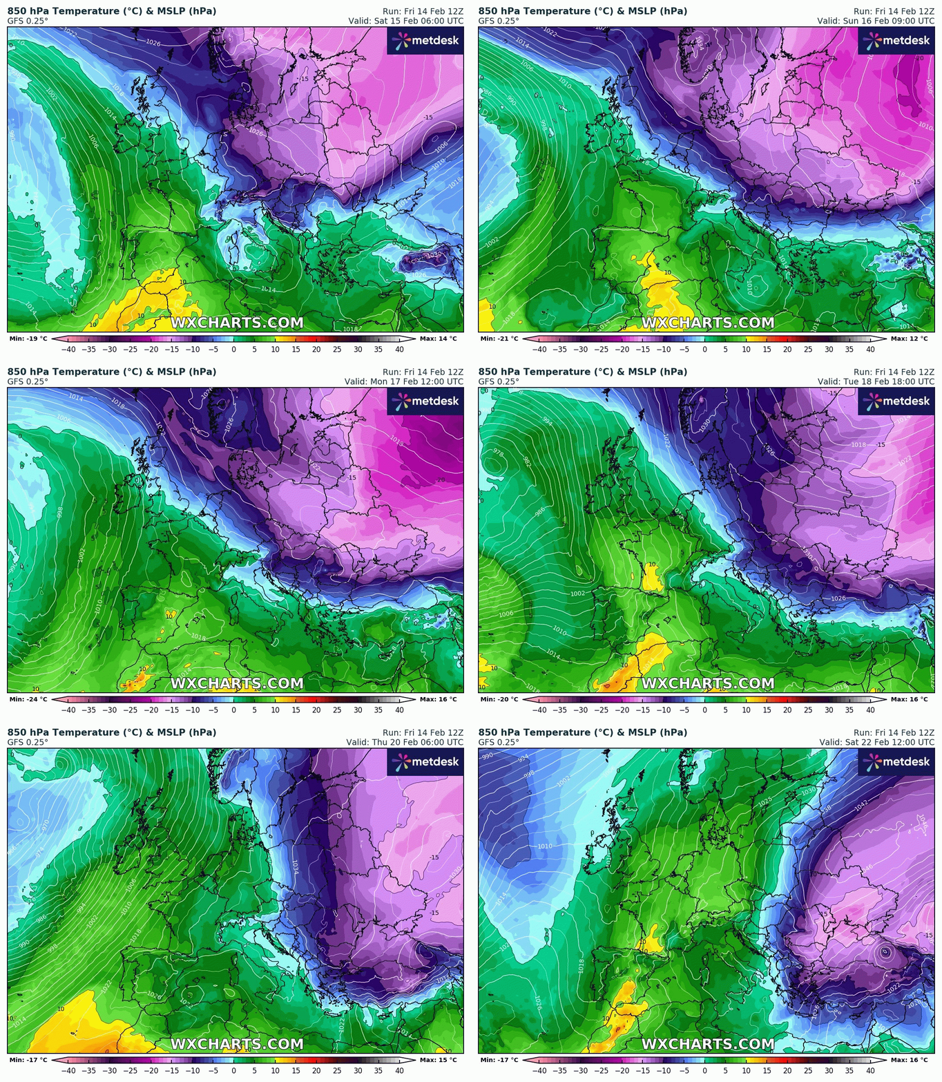
Weak weather fronts bring a "battle zone" between cold continental and milder Atlantic air to start the week the colder air wins for a few days
Then the Atlantic low pressure will strengthen into the middle of next week and this will pull much milder air our way on a strong Southwesterly flow.
Temperatures will reach double-digits in many places by Wednesday, with 13 or 14C possible on Thursday and Friday, we have been lucky to see 5/6C for the last week or so
But there is a downside with the milder air comes more Atlantic moisture and outbreaks of showery rain at times. There could be some drier and brighter spells
And as is often the case with more low-pressure influence, the winds may become more of a feature once again, While it is still too early to say when exactly gales develop, periods of stronger winds are likely to affect some places
The mild and unsettled weather looks to last into the final week of February, with more low-pressure systems bringing spells of rain and strong winds as well.
www.favershamweather.org