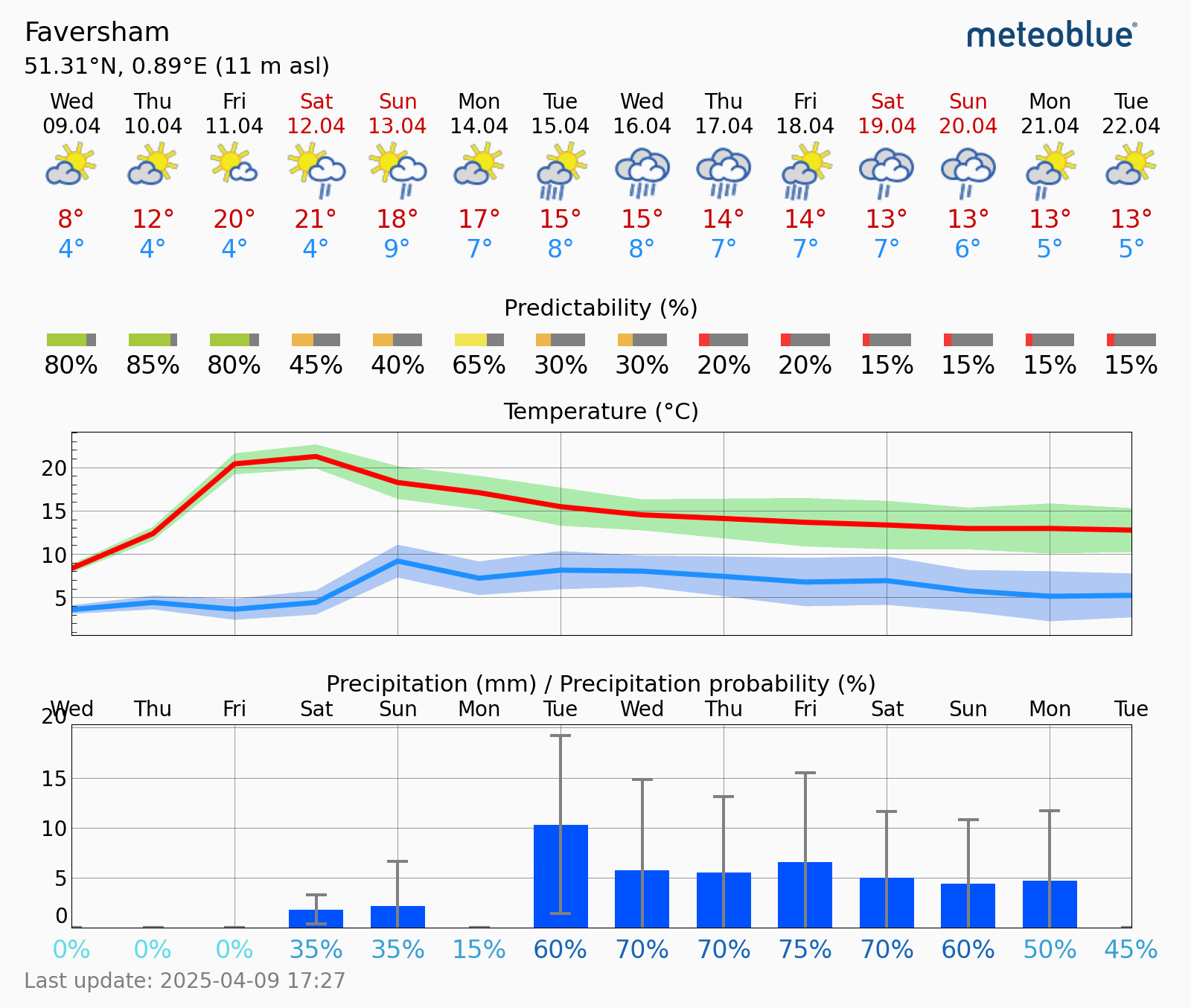

After a few weeks of unusually dry and often sunny weather, it looks to carry on for the next few days with the High pressure situated to our North keeping things settled for a while longer.
While temperatures here have been mild, there have been some very warm spells further West and South, but with the Northeasterly onshore breeze of the North Sea, it has not felt like it here. In fact, it's been quite cold at times
As the High pressure then finally weakens over the weekend and starts to move away, the chance of rain is set to slowly increase on Saturday and Sunday, with some showers perhaps moving in from Northern France, more so on Sunday
Then next week looks to turn much more unsettled with the forecasts showing an even higher chance of heavy, thundery showers in places. It's not all bad. there will be some dry spells
Temperatures will also fall back a little with the increase in clouds and showers, though still remain around where they should be this time of the year.
Then the big question is, what about Easter weekend at the moment Good Friday looks to be a bit wet, then the rest of the weekend is looking drier, but it is over a week away, so things could change. but it will remain on the cool side
www.favershamweather.org