

> Nigel forms, Lee + Margot ends <
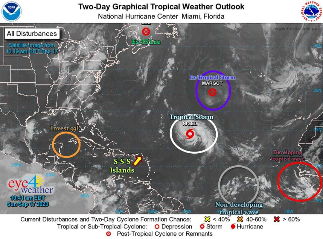
From left to right…
* Green:
Lee lost its tropical-cyclone-status at 5am Saturday morning, while its remnants brought minor effects to northeastern USA + southeastern Canada.
…the final advisory on Lee was issued at 11am today.
* Purple:
Margot also lost its tropical-cyclone-status at 11am this morning.
…The remnants of Margot will continue making a slow clock-wise circle in the central north Atlantic and possibly bring minor effects to the (Portuguese) Azores Islands.
* White:
Tropical Storm Nigel (formerly Tropical Depression#15) formed at 11pm last night in the central Atlantic -- about midway between Africa & the Caribbean.
...it will likely further strengthen into a hurricane by Mon -- while passing well NorthEast of the Caribbean.
...Nigel poses no direct threat to the Caribbean, but can kick up rip currents/ground swells during the next few days -- use Sea Caution!
* Grey:
A non-developing tropical wave -- centered along 36°W -- currently has no chance of developing.
…it currently poses no threat to the Caribbean, but may bring a couple showers to the SSS & surrounding Islands by this weekend.
We will continue to monitor its progress.
* Red:
The developing tropical wave, which is expected to emerge off the coast of Africa by Tue/Wed -- already has a low (0%) to medium (40%) chance of developing within the next 2-7 days.
…it is way too early to determine the outcome of this system.
We will definitely continue to monitor its progress.
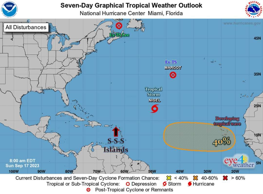
⚠ we are at the PEAK of the Season...
#RemainAlert #StayPrepared
Keep checking back for updates
__________________
2023 Hurricane Season:
>> So far: 15 trop. storms, 5 hurr’s, 3 major
>> Expected: 13-18 tropical storms, 6-8 hurricanes (3-4 major)
* Normal Season: 14 TS, 7 H (3 MH) --> 2023 = near- to sl. above-average!
__________________
Reminder:
* St. Maarten = 18.0°N, 63.1°W
* Saba = 17.6°N, 63.2°W
* St. Eustatius = 17.5°N, 63.0°W