

Don now a TD, trop. wave to bring some 🌧
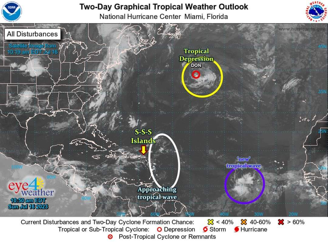
From left to right:
* White: A weak tropical wave (now centered around 54°W) -- which has some shower activity associated with it, yet currently has no chance of developing within the next few days -- is expected to bring a couple showers to the Lesser Antilles (including the SSS Islands) today, tonight & tomorrow.
...these showers are not expected to be heavy, but brief and sporadic in nature -- meaning here & there.
* Yellow: Don was downgraded to a tropical depression at 11am this morning.
...it is expected to further diminish within the next couple days, as it moves further away from the Caribbean & towards cooler open waters.
...effects to any land areas: none.
* Purple: Yet another 'new' tropical wave, which is centered around 26°W -- has limited shower activity associated with it, and currently has no chance of developing within the next few days.
We will continue to monitor the Atlantic, as we are mid-way through the 2nd of 6 months of Hurricane Season.
#RemainAlert #StayPrepared
Keep checking back for updates...
________________
2023 Hurricane Season:
>> So far: 5 trop. storms -- incl. the 1 in Jan'23
>> Expected: 13-18 tropical storms, 6-8 hurricanes (3-4 major)
* Normal Season: 14 TS, 7 H (3 MH) --> 2023 = near-average!
________________
Note: Typical development of a tropical system:
Tropical Disturbance/Tropical Wave --> Tropical Depression --> Tropical Storm --> Hurricane --> Major Hurricane
________________
Courtesy: Eye 4 Weather