

> Atlantic "waking up" <
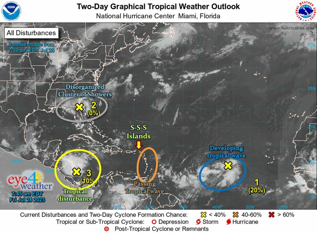
From left to right:
* Yellow:
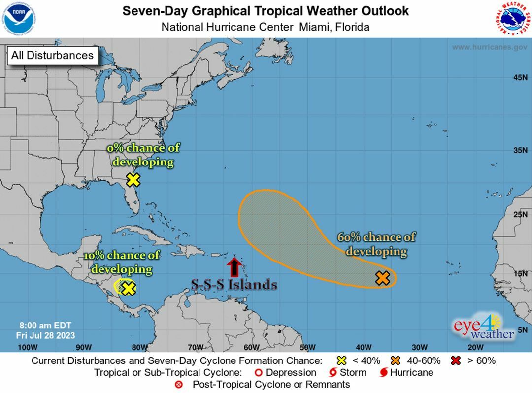
A tropical disturbance near Central America has a low (10%) chance of developing before it moves further inland today.
...it is also expected to re-emerge in the Pacific Ocean in a few days, after bringing heavy thunderstorms & possible flooding to parts of Central & South America.
...this system is no threat to the SSS Islands.
* Grey:
An area of disorganized showers & thunderstorms has a minimal (0%) chance of developing as it affects and moves inland of the southeast USA (FL, GA, SC).
...this system is no threat to the SSS Islands.
* Orange:
A weak tropical wave has no chance of developing as it passes through the Lesser Antilles today & tomorrow.
...it is currently centered along 62°W, moving West at +/- 17 mph.
...this trop. wave will likely bring Showers (some possibly heavy) to the southern Caribbean today, then light Showers to the northern islands (including the SSS Islands) by this afternoon/evening into tomorrow.
* Blue:
The developing tropical wave located about midway between Africa & the Caribbean (centered along 40°W) currently has a low (20%) to medium (60%) chance of developing within the next 2-7 days.
...it is currently moving West at +/- 17 mph, and is expected to pass to the NorthEast of the local region (SSS & surrounding Islands) late Sat through Mon.
...regardless of development, it will cause minimal effects (i.e. elevated seas, a few poss. Showers & maybe some gusty winds) to the SSS Islands.
...we will continue to monitor its progress.
#RemainAlert #StayPrepared
Keep checking back for updates
________________
2023 Hurricane Season:
>> So far: 5 trop. storms, 1 hurricane
>> Expected: 13-18 tropical storms, 6-8 hurricanes (3-4 major)
* Normal Season: 14 TS, 7 H (3 MH) --> 2023 = near-average!
________________
Reminder:
* St. Maarten = 18.0°N, 63.1°W
* Saba = 17.6°N, 63.2°W
* St. Eustatius = 17.5°N, 63.0°W
________________
Courtesy: Eye 4 Weather